Monday, March 19, 2018

Cloudcroft, New Mexico - Elevation 8700 Feet

On Saturday we visited Cloudcroft, New Mexico, a small resort village located in the Sacramento Mountains at an elevation of about 8700 feet.  It was 70 degrees in the desert when we left and 40 degrees at Cloudcroft when we got there.   The town has many shops and is located in the Lincoln National Forest which has many hiking trails mainly on the old rail bed of the El Paso and Northeastern Railroad built in the late 1800's.

The Downtown Area


Donna, Darby and an 8 foot wooden Indian


We hiked one of the trails to one of the many railroad trestle bridges.  We only went two miles but it seemed like five at the 8700 foot altitude.

View from the trail - the white near the center of the image is White Sands 4400 feet below (the White Sands are at 4300 feet elevation) and about 30 miles away.

One of the unique bridges on the railroad route

The bridge collapsed in 1960 - this is what is left


Saturday, March 17, 2018

Three Rivers Petroglyph Site - Lincoln National Forest

Yesterday we went to the Three Rivers petroglyph site which is located in Three Rivers, New Mexico, about 20 miles north of where we are staying.  The petroglyphs are attributed to the Jornada Mogollon people approximately 800 to 1000 years ago.  There are over 21,000 petroglyphs at this site. 


Circle and dot motif - very common at this site - no one is sure exactly what they represent. 

Lots of drawings represent wildlife


This is the most famous petroglyph at this site - bighorn sheep pierced with three arrows


Masked figure with corn stalk


Panoramic view from the petroglyph site - Sierra Blanca peak in center, the snow capped mountain (click to enlarge)

Close-up of same view

Adjacent to the petroglyph site are remains of the Mogollon village 


Remains of a pit house


Remains of another structure


Remains of an adobe structure

Dogs are not allowed at the petroglyph site so when we finished there we went further up the road into the Lincoln National Forest and took Darby on a hike.  This is at about 6000 or 7000 foot elevation and is a totally different landscape than that of the desert below - lots of tall trees, hills, water in the creeks and much cooler.  We did see a couple of mule deer on the hike but didn't get any pictures.

The start of our hike.

Wednesday, March 14, 2018

Mountain Meadows Campground, White Sands National Monument, Worlds Largest Pistachio

We are now in Tularosa, NM at Mountain Meadows RV Park - this is just a few miles north of Alamogordo,  New Mexico.  The park is not bad - we are in between two buildings so I couldn't get a good picture of the site but it is better than it looks - we are away from the other campers and have a lot of space.

Our Route

 Our Site

The arroyo behind the campground

Close-up of the arroyo

View of our campground from the desert with Sierra Blanca peak (11, 981 Feet) in background 

We spent part of the day today at White Sands National Monument - the pictures below don't really capture the uniqueness and scale of this place - it is truly breathtaking - 275 square miles of white sand dunes located between two mountain ranges with many peaks in the 7000 to 8000 foot range.  This is a place that shouldn't be missed if you are anywhere near the area.

The visitor center - built in the 1930's in authentic Pueblo Revival style 

Panoramic view of the dunes (click to enlarge)

View Of The Dunes

Donna And Darby On The Dunes

People sliding on the steep dunes with flying saucer sleds

                                                       Donna And Darby On The Dunes

More dunes

The road in - note that they have to use a snowplow to keep the road open due to drifting sands

More Dunes

View of our truck from the dunes

On our way back from White Sands we stopped at Pistachioland, home of the world's largest pistachio.  This is a pistachio farm and winery with a large gift shop. 

Donna in front of the 30 foot pistachio

Part of the pistachio orchard

Also on the way back we stopped to take another pic of Sierra Blanca Peak from a different angle

Saturday, March 10, 2018

Bottomless Lakes State Park, Antelope, Siera Blanca Peak

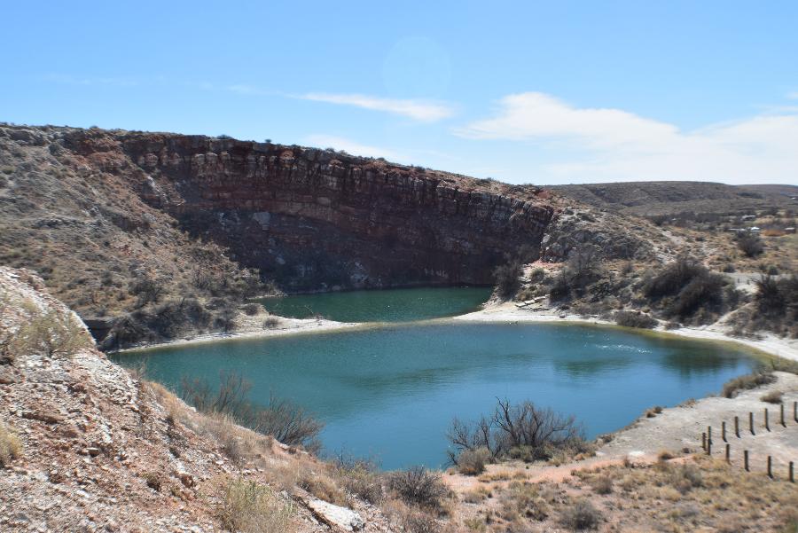
We took a short trip to Bottomless Lakes State Park today to do some hiking.  Bottomless Lakes SP is a series of  nine sinkholes that have filled with water.  They were formed much like Carlsbad Caverns when surface water water eroded the limestone and gypsum layers of rock beneath causing caverns.  The caverns collapsed causing the sink holes which filled with fresh water. 

Double Sink Hole  Called Figure Eight Lake

Donna And Darby On The Edge Of A Sinkhole

Another Sinkhole

The Largest Sink Hole - Lea Lake 

Herd of Antelope Just Outside The Park 


On the way back from the park took this view of Sierra Blanca, an 11,981 Foot Inactive Volcano. This pic is from about 80 miles away - we should be driving past this en route to our next destination - will try to get some better pics of it.