Tuesday, March 12, 2019

Joshua Tree National Park - Desert Super Bloom - Chiriaco Summit

Joshua Tree National Park is named for the Joshua Tree that grows primarily in the Mojave and Sonoran  Deserts. Legend has it that Mormon pioneers named the tree after the biblical figure, Joshua, seeing the limbs of the tree as guiding the travelers westward.   This is a huge park - we put on over 100 miles driving inside the park.

South Entrance to Joshua Tree National Park

We were fortunate to have been here when a rare "super bloom" was in progress in the desert.  Above average rainfall and moderate temperatures produce this rare occurrence where the desert floor is blanketed with wildflowers in early March.


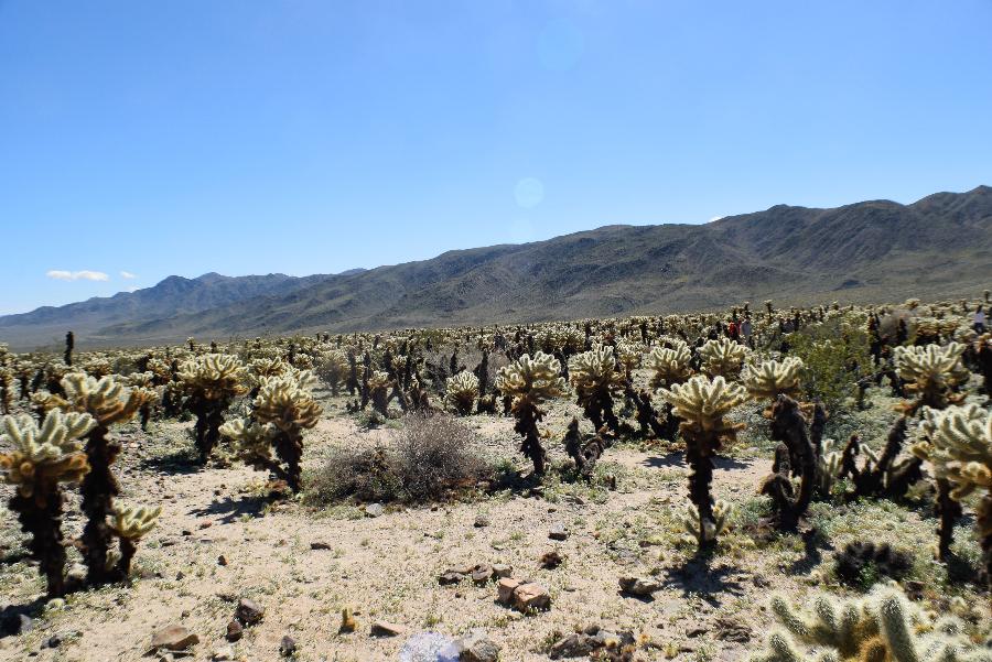
Cholla Cactus Garden - a rare concentration of 1000's of Cholla Teddy Bear Cactus


Skull Rock - the park is noted for its many unusual gneiss rock formations 

Skull Rock

Another view


Joshua Trees

Joshua Tree 

Another

Nearly 11,000 Foot Mount San Jacinto (snow-capped peak in clouds just right of center) taken from  Keys View, the highest point in Joshua Tree National Park 

Coachella Valley, the Salton Sea, and Palm Springs in the distance - it was hazy so they are difficult to make out - taken from Keys View

Chiriaco Summit - a small community that is primarily a travel stop - it has a store, restaurant, Post Office, antique shop and gas station along with a free RV campground and the General Patton Museum. This area was used by General Patton for a desert training center in WWII.

Lots of relics on display around the grounds - this is a Model T Dump Truck

Visible Gas Pumps from the early 1900s

History of the Chiriaco family who founded the village

Large prickly pear cactus in bloom

Some old tanks behind the museum

Our RV behind the tanks (last one on the left)

Our site

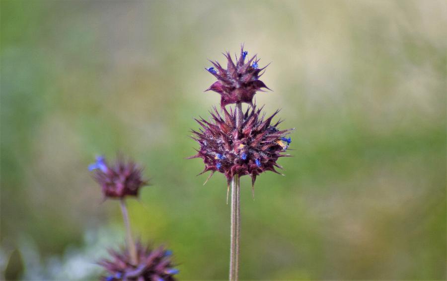
Some of the desert flowers and cacti near the campsite


California barrel cactus - rare and endangered due to loss of habitat

Sunday, March 10, 2019

Los Algodones, Mexico - Winterhaven, California

We have moved to Chiriaco Summit, California, just outside Joshua Tree National Park with stops in Tucson, Gila Bend, and Yuma, AZ (actually Winterhaven, CA a suburb of Yuma).  While in Yuma we visited Los Algodones, Mexico, the northernmost point in Mexico - it is actually north of much of Yuma, AZ.

This blog is mostly about Los Algodones - we will cover Joshua Tree National Park in our next blog (we went there yesterday). 
Our Route

Our site at Snyder Hill BLM camp near Tucson, AZ

View of our site from atop the hill - our RV is in the center

View from the hill showing the residential area of Tucson - the city is on the other side of the small mountains (click to enlarge)

A pair of barrel cactus in bloom

Our site in Winterhaven, CA near Yuma

The Ocean To Ocean Highway Bridge in Yuma -   built in 1915 it was the first truss bridge to cross the southern Colorado river and was an important link of the Coast To Coast Highway, designated Route PP-OO, in the 1920s and 1930s. The Ocean to Ocean Highway, aka Pikes Peak Ocean To Ocean Highway, ran from Los Angeles to New York City. The bridge was also used by the California State Police in the 1930s during the Great Depression and the Oklahoma dust bowl period to deny refugees from Oklahoma entry into California. If you look closely you can see "Ocean To Ocean Highway" lettering on the bridge.

Sign as you walk into Mexico at Los Algodones (we parked on the US side and walked over) 

Los Algodones is noted for its inexpensive dental and eye care and low-cost prescription medicines - a lot of Americans and Canadians come here regularly for these services

Everything is very colorful

A typical street

Can you find Donna?

Lots of clothes and crafts for sale


Open Air Restaurant


We took a break at this sidewalk cafe - the live music was very good


The line waiting to cross back into the US - no line to get into Mexico - about an hour wait to get through the border check going back to the US

The wall from the Mexican side

Port of entry from the US side near where we parked